Occurrence and distribution
From 50 meters in Texas to nearly 1850 m in the state of San Luis Potosí.
Anderson 1980; occurrences along the Rio Grande near Reynosa, Taumaulipas are less than 50 m while occurrences in San Luis Potosí exceed 1800 m Anderson 1969; Below 3000 ft (1,000 m) usually. Lamb & Lamb 1974; At 150-1200 ft (50-400 m) Benson 1982
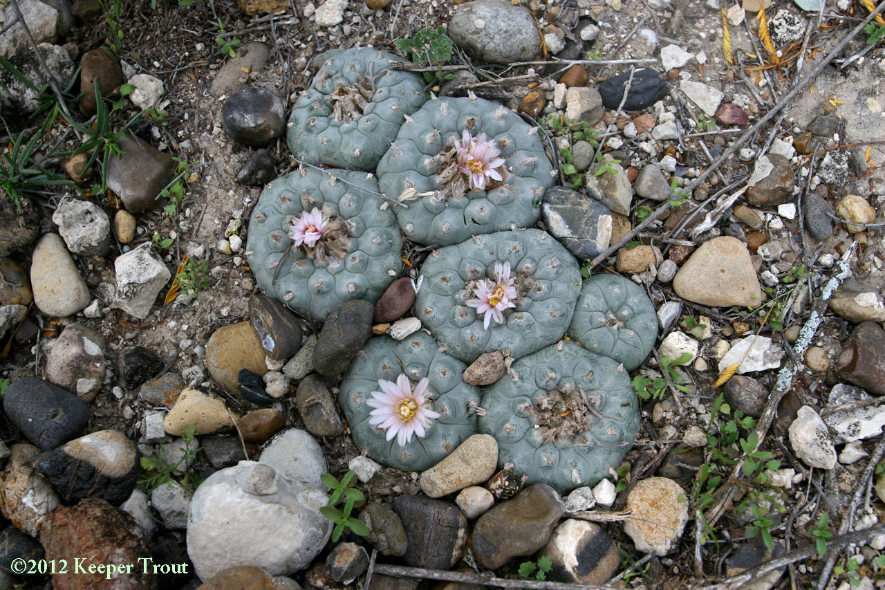
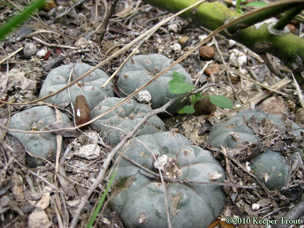
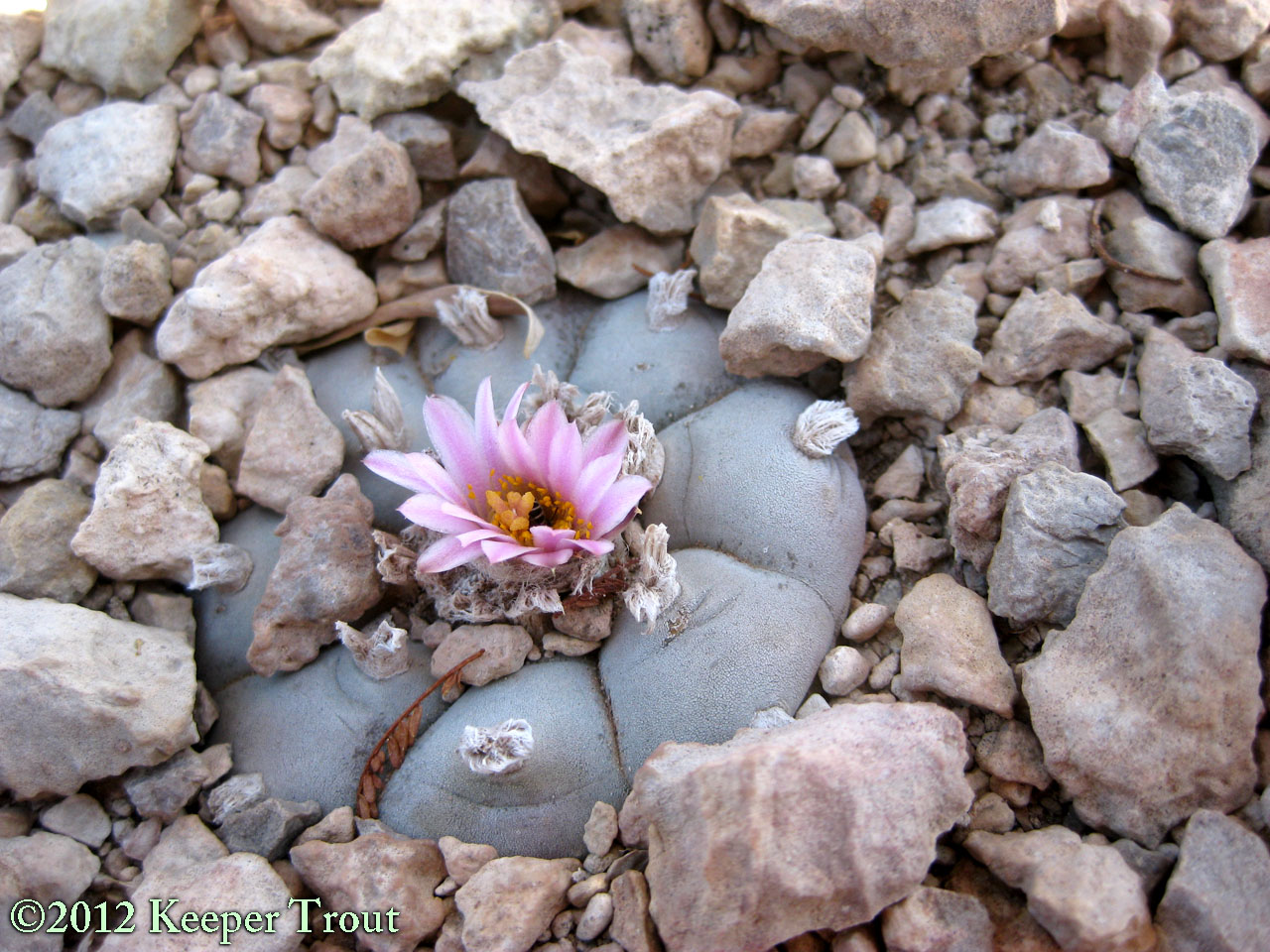
Peyote grows isolated or in groups. It can occur as very dense populations, sometimes including large clumps, or be widely scattered as individuals. It is found in calcareous deserts or subdeserts, on rocky slopes of low hills, ridges, alluvial fans or in dried river beds.
east of Rio Grande City in Starr County
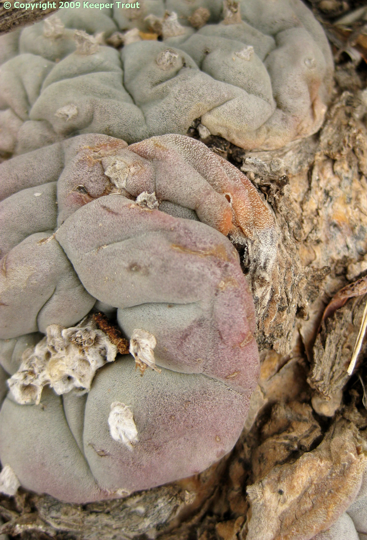
Lines showing this white mottling continue to do so in horticulture.
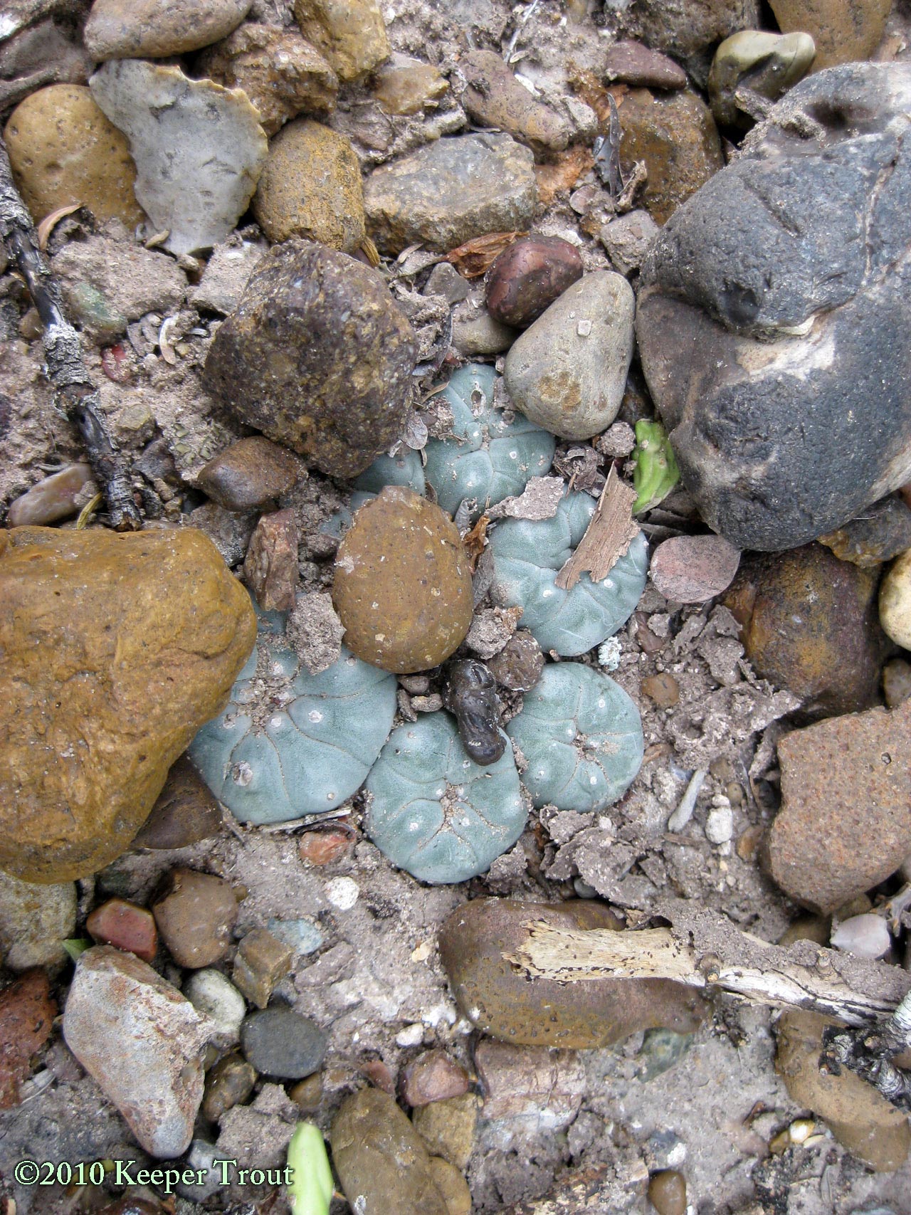
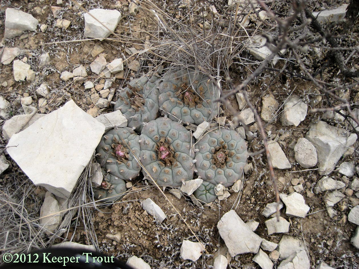
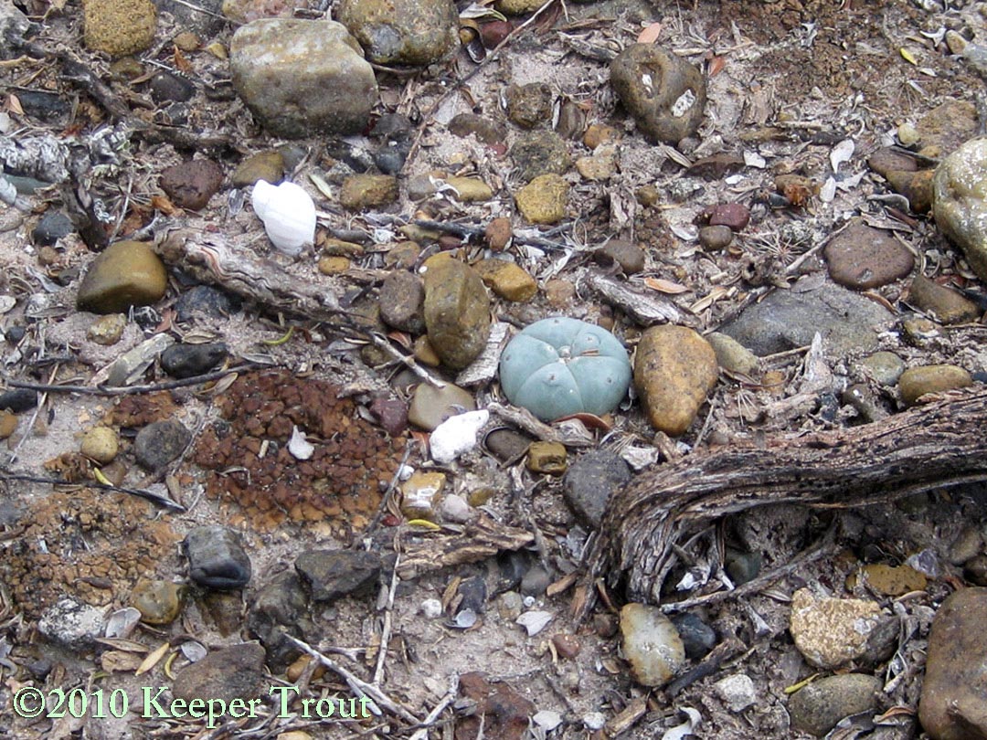
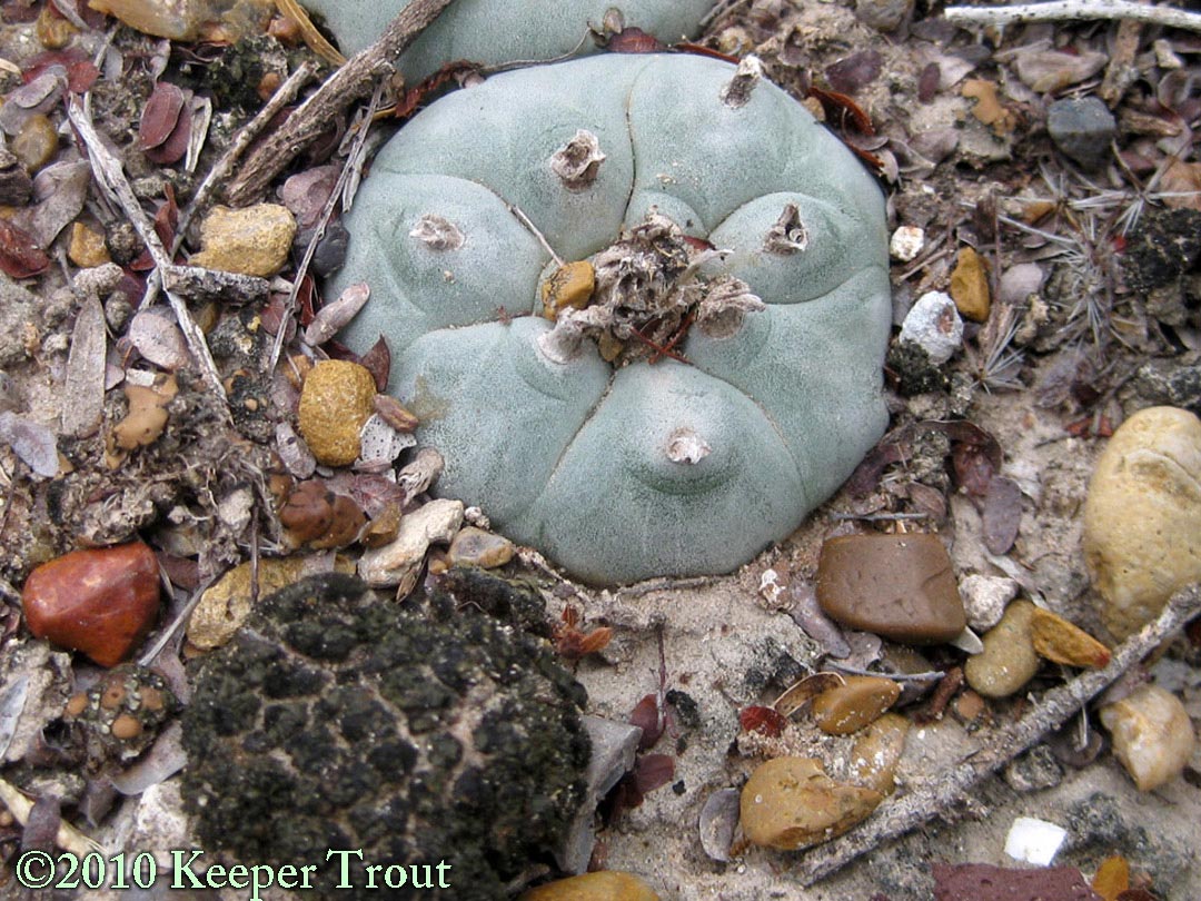
Soil surface in Jim Hogg County
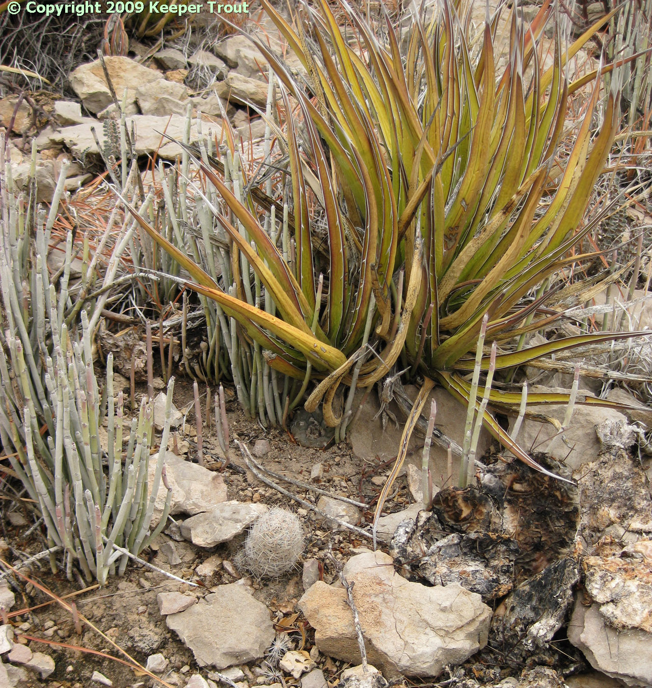
Often they are found in limestone, flaky limestone or partly limestone soils; on slopes of small hills, especially if overlying rocks are caliche. Also, found in gravel or stony soils. Morgan 1983 found populations to be more abundant on east and south facing slopes.
Peyote occurs in many soil types. These are typically limestone soils or contain limestone, and may be rocky or even gravely. Soil types in Texas are discussed by Morgan 1983: “All tend towards upland shallow to moderately deep, calcareous, clayey loams.” LaBarre notes that in the northern portion of its range it occurs in primarily calcareous and argillaceous soils of the Cretaceous formations.
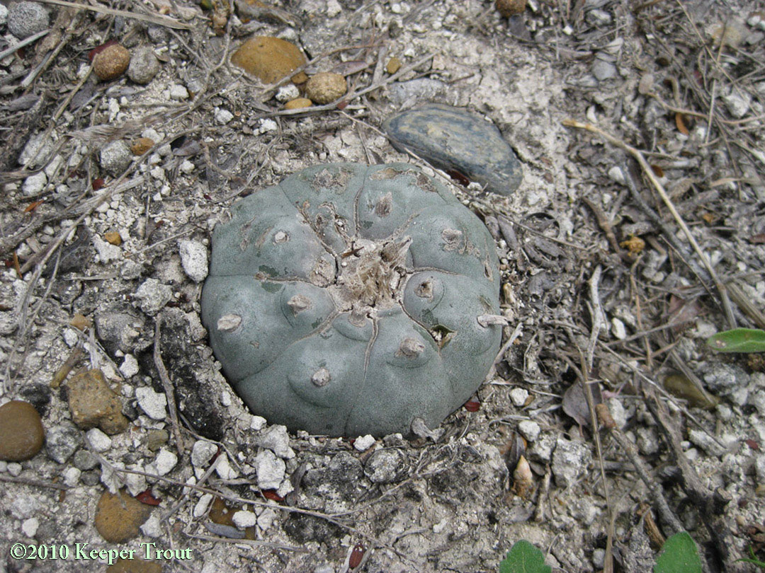
Soil in Presidio County
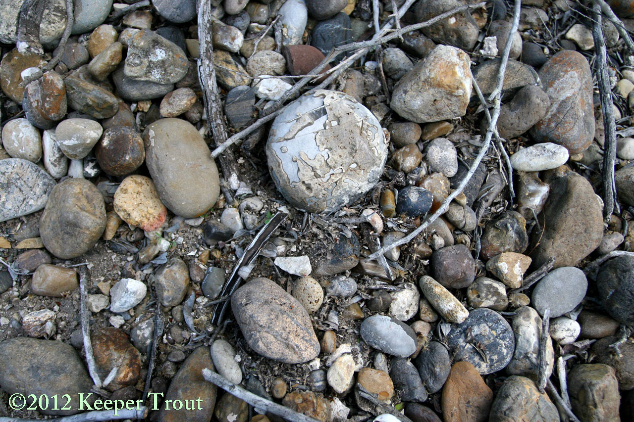
Soil in Terrell County

Soil in Presidio County
Widely distributed in Chihuahuan Desert and Tamaulipan Brushland of the Rio Grande Plain, of Texas, also south of Shafter, and, prior to its damming, at the mouth of the Pecos River, and from Laredo southeastward to McAllen. (Almost to Brownsville according to Anderson 1995 but this refers to a photo in Britton & Rose that is a certain error. Peyote has never occurred “near” Brownsville as both the soil and the terrain is wrong.)
In Texas; originally near the Rio Grande from highly localized spots in Presidio through Starr Counties, historically occurring as far south as the edge of far western Hildago Co although that area has been so intensively agriculturalized it is hard to imagine there are *any* populations left anywhere in Hidalgo County. They have seemingly been reported near Brownsville but this is surely in error. (See fig. 97, page 84 in Britton & Rose 1922 who probably chose Brownsville simply as their closest known landmark), and eastward into parts of Jim Hogg Co. It was once so abundant in Starr and Jim Hogg county that portion of the Bordas Escarpment has been referred to as The Peyote Gardens (leading some authors to assume cultivation occurred there). The vast majority of that land has been cleared at least once so peyote is now gone.
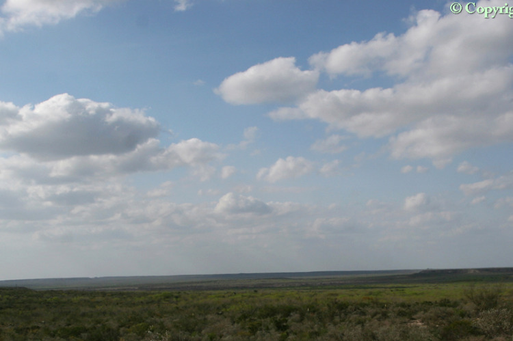
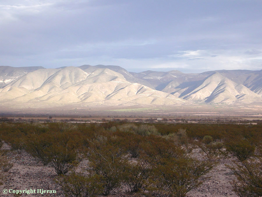
The featured image at the top of the page shows a view across the Bordas Escarpment AKA the “Bordas Scarp”. The image below was taken on the Bordas Scarp looking west across an area of prime peyote habitat.

Habitat in Jim Hogg County

Habitat in Jim Hogg County
Soil in Jim Hogg County
Soil in Jim Hogg County
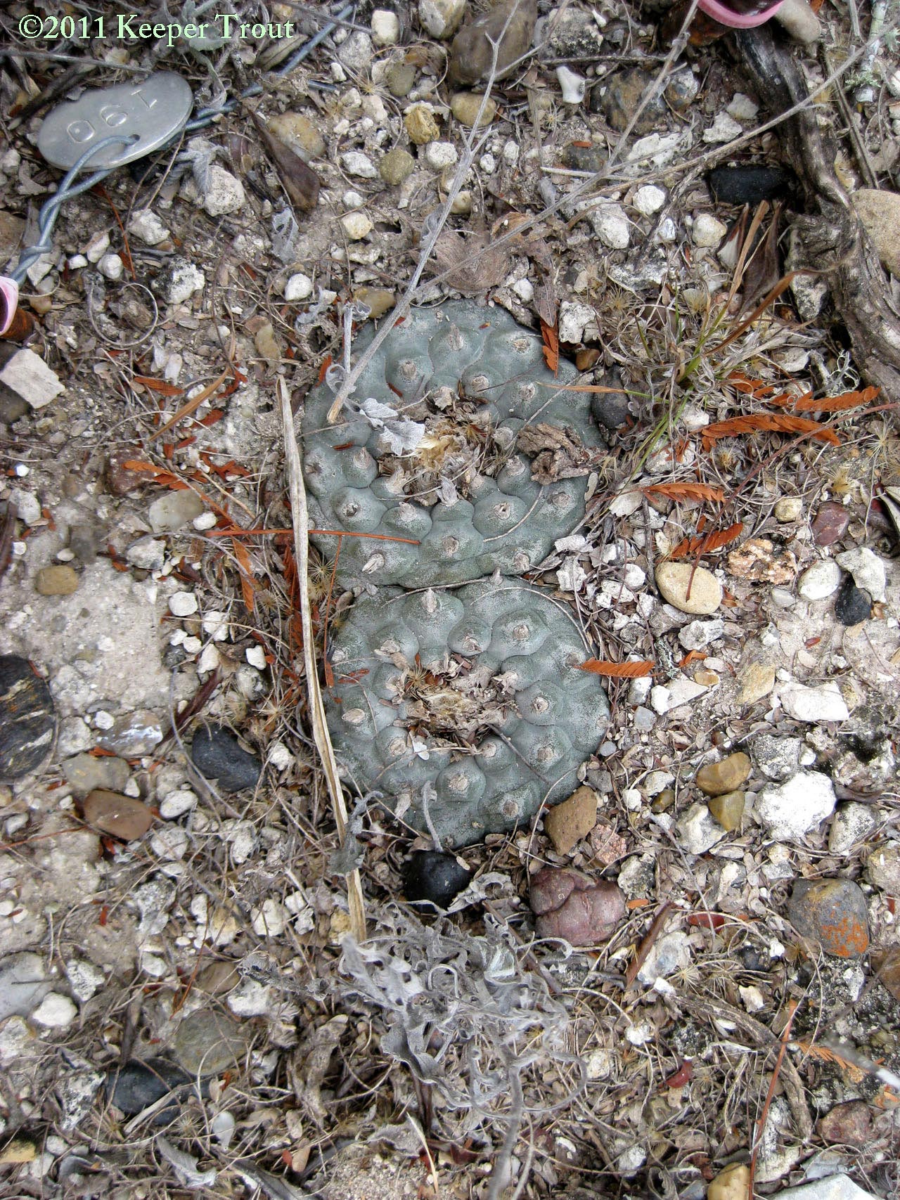
Soil in Jim Hogg County
Plants have been reported or claimed from Brewster, Cameron, Crocket, Culberson, Dimmit, Hudspeth, Jeff Davis, Jim Hogg, Kinney, Maverick, eastern Medina, Pecos, Presidio, Terrell, Tom Green, Starr, Sutton, Uvalde, Val Verde, Ward, Webb, Winkler, Zapata, and Zavala counties. Its historical presence in all of those counties spans the range from certain through doubful to implausible.
Most of the remaining populations are in Starr, Jim Hogg, Webb & Zapata Counties. Several other counties still have small and scattered populations, while the rest are certain to be errors or may have once held populations that have been extirpated. While plants may have been reported from those areas in the past, its actual range of occurrence is now far smaller.
soil in Starr County (notice the nearby crust communities)
Soil in Starr County (again notice the presence of a crust community)
In Texas, its highest concentrations seem to be contained within a narrow band no more than 30 to 40 miles from the Rio Grande.
The vast majority of its native habitat in Texas has been destroyed by root plowing and land conversion for agriculture and pasturage. It has been considered an endangered member of Texas flora by the Texas Organization of Endangered Species (TOES) since the late 1970’s for this reason despite not being categorized as an endangered species at the federal level.
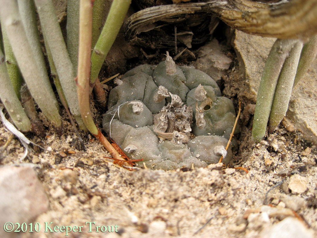
Sheltered by palo verde in Starr County
According to Morgan 1983; it is most common in Texas along the western margins of the Bordas Escarpment, the Aguilares Plain and in the Breaks of the Rio Grande.
Occurrences along the Pecos River (an area of numerous fine examples of shamanic rock art) are in many case gone due to the formation of Amistad Reservoir. Even if populations survived above the water line, it might be wondered just how well peyote would adapt to being a lake-side plant. Schultes & Hofmann 1992 note peyote remains found in this region’s rock shelters and dry caves show its use to be present for 3000 years or more. Weniger commented on not being able to locate it growing there in 1970.
It has been reported at scattered locations throughout Trans-Pecos Texas. The few populations I am aware of are all small and sharply defined. A site may contain its entire population within a zone that is no more than 30 feet by 200 feet.
Some of the occurrences in the TransPecos have been the results of deliberate plantings by indigenous people including one planting that was done in volcanic ash rather than limestone. Interestingly the mineral content and pH was not too far off from a limestone soil and what few plants survived have managed to produce a few successful seedlings. A collector gathering a couple of dozen plants would entirely wipe out the entire tiny population. Around half of the known plants at that site were in fact lost when someone collected them within just the last several years.
Plants have been claimed from as far north as New Mexico, south of Capitan Mountain, but this commonly experiences the lowermost limits of their winter temperature tolerance so it is doubtful that any populations exist in either New Mexico or in the northern part of Trans-Pecos Texas. In the US, Weston LaBarre considers Deming, New Mexico to be its northern limit (!?) and Corpus Christi to be its southern limit (!?). Both of which are not realistic to believe. In Texas, peyote has been reported from as far west as Hueco Tanks where those plants, now long gone, were believed to have been planted by indigenous people.
Occurrences have also been claimed in the Davis and Guadalupe Mountains which seem to also have climates that would challenge any of the known populations.
I think (as do a number of others) that climatic changes may have substantially reduced peyote’s natural range from where it once was and that the sporadic northern populations in Trans-Pecos Texas are hardy remnants of this earlier distribution. It is also probable that postglacial megaflood events shaping the landscape played a role in removing both entire populations of plants and their natural habitat. Much of that gravel interestingly enough ended up in South Texas creating a home for many of the present day Lophophora populations. One element which is easily overlooked is that not only did west Texas see massive land removal during the post-glacial meltings but prior to that during the last period of glaciation West Texas was relatively mild (certainly not any worse than it has been after the end of glaciation) and had more moisture due to the influence of the ice masses on air currents in North America. (See the youtube video Keeper Trout 2011 Lophophora A genus in Decline and a forthcoming book chapter in Labate & Cavner 2015 Peyote & People, for more details of the above facts and speculations.]
Some such as Hueco Tanks, extirpated in historical times, and in Big Bend, known to consist of only a very few plants, likely were the hardy survivors of plantings made by the ranging peoples who regularly moved through the area or perhaps by the Jumano who farmed many crops in West Texas and had extensive trade networks with their neighbors — at least prior to the arrival of the Apache. A friend in Midland successfully grows peyote in an unprotected outdoor garden and has seen them covered with snow several times with only small losses.
However, in any population of slow growing plants, even small losses, if recurrent, may completely wipe them out of an area over a period of many years. Stresses like injury from harvest greatly increase the threat of death from cold and wet or prolonged drought.
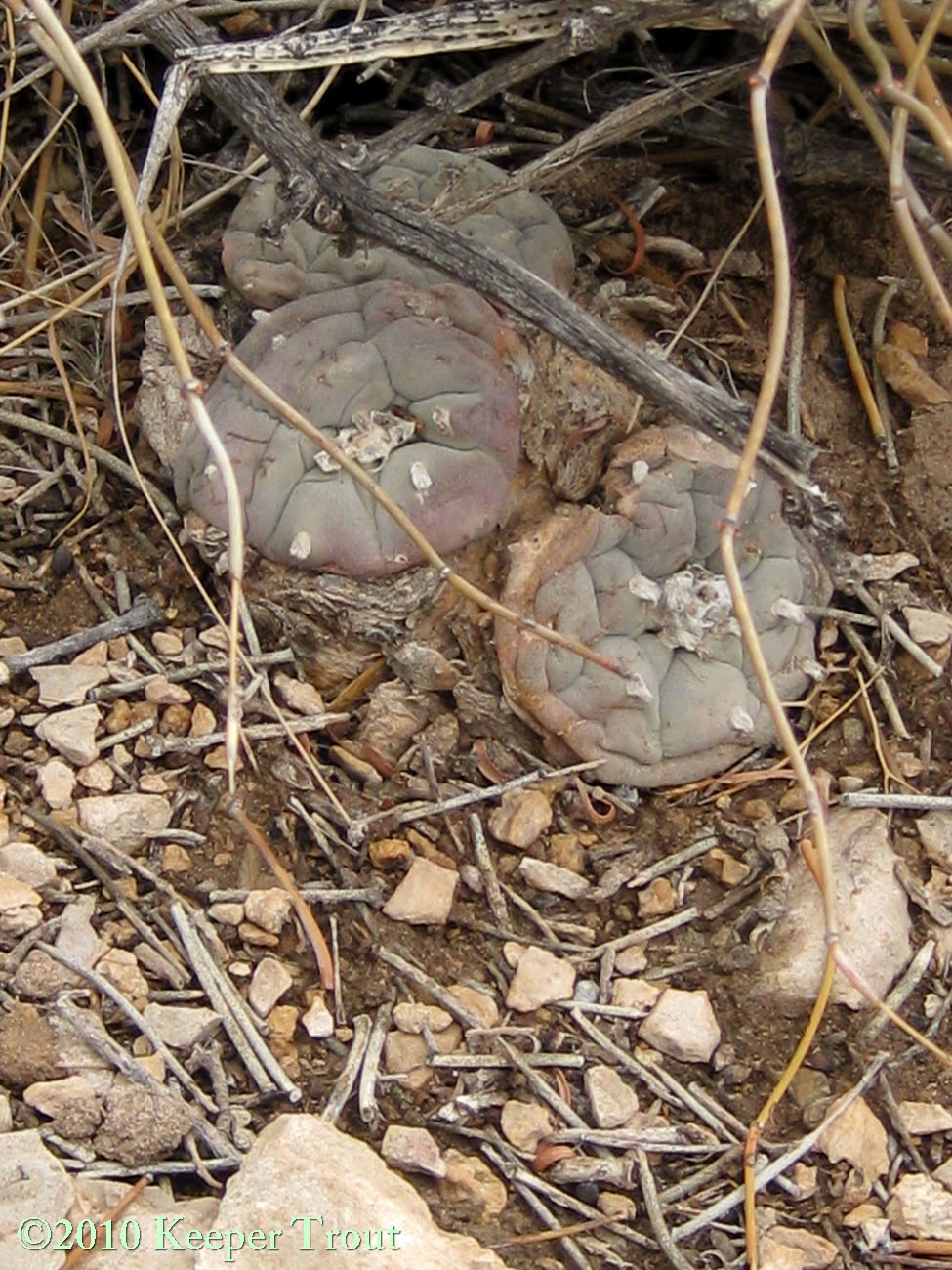
Soil and stressed plants in Presidio County
A closer view of that cold-stressed plant
Soil in Presidio County
Anderson dismissed ALL of the northernmost reports of occurrence.
It should be emphasized that, like Anderson, Stewart 1987 disputed ALL extensions of distribution beyond those given by Anderson, basing this on his inability to find any demonstrable evidence of peyote’s occurrence in those regions.

Habitat in Val Verde County
Stewart is largely right (with some exceptions) but he heavily based his opinion on landowner’s responses to questionnaires and interviews with peyoteros. [Note 15] Field work has shown his conclusion to be premature but understandable. Its easy to imagine many ranchers and landowners could own property all of their life and never have reason or opportunity to see what few and scattered groups of a few plants might be on that land.
It actually is certain that Stewart is largely right but that he is partially wrong if making that as a blanket statement. A feature that probably contributes with the Trans-Pecos populations is what was just noted: they are small in size and widely scattered. This seemingly grows more true as one goes farther north but I do not know the issue has been studied in depth by anyone. It has been the case in the only two northernmost ones I have seen that their entire populations was contained within an area that of only 10-20 meters by 75-150 meters. One in Val Verde County was at the lower end of that and one in Terrell County was on the upper end of that. The one in Val Verde might not have contained enough plants for more than a single modern peyote meeting. Relatively small areas containing any density of plants seem to be the norm even farther south in West Texas.
habitat in Presidio County
One possible contributing factor to Stewart’s questionaire not producing better results is the simple fact that many landowners would not WANT anyone to know there is peyote on their land even if they knew about it. In that case there would have had no problem not cooperating with Stewart’s inquiries. Choosing to avoid potential problems due to going “on the map” for having a peyote population is a reasonable response. There is no doubt actual wisdom in that as contributing to there being an accurate map of peyote distribution would serve little purpose outside of perhaps enabling more harm to be done to peyote populations.

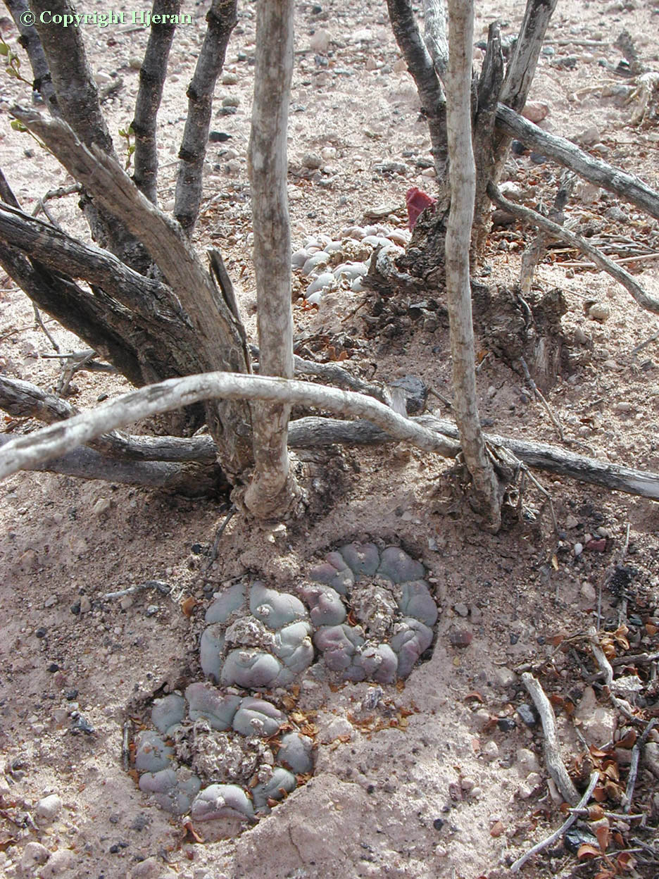
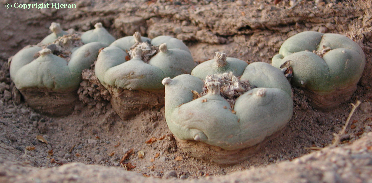
Wirikuta. Photo by Hjeran
They are widely distributed throughout the central highlands of northwestern Mexico and extend southward from the border in a broad area across the basin regions between the Sierra Madre Occidental and the Sierra Madre Oriental, extending south until just south of Saltillo where the range is narrowed by mountains.
It then expands again west into part of Zacatecas and eastward into the foothills of the Sierra Madre Oriental, into central Mexico as far south as north of San Luís Potosí. The range is separated from the more southerly high desert L. diffusa by rugged mountains.

Lophophora williamsii habitat at Wirikuta. Photo by Hjeran
LaBarre describes its range in Mexico as being defined by the Tamaulipecan Mountains in the east, “the watershed of the affluents of the right bank of the Rio Grande de Santiago and the Rio de Mezquital” in the south and “the foothills of the Sierra Madre, the Sierra de Durango and the Sierra del Nayarit” in the west.
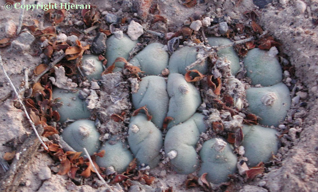
soil at Wirikuta. Photo by Hjeran
In Mexico, scattered populations have been found in Aguas Calientes (proposed to have been established through wildcrafting by the Aztecs), Chihuahua, Coahuila, Durango, Hildago, Jalisco, Nuévo Léon, Querétaro (according to some; this is likely mistaken), San Luis Potosí, Sonora (according to Rouhier), Tamaulipas and northeastern Zacatecas. Possibly the most famous area is in the Real del Catorce, below the once thriving silver mining town of Catorce. Another reknown ancient collection site is the Cerro de Peotillos near San Luis Potosí.
Bohata et al. 2005: “Typically, the centre of distribution is the place of greatest plant density for the species. This centre for L. williamsii is in the northern part of the state of San Luís Potosí, the south-western part of Nuevo León, and the south-eastern part of Coahuila.”
soil at Wirikuta. Photo by Hjeran
[Anonymous 1959, on page 22, includes Sonora. They cite as their source, Rouhier 1926 who they state drew his information from a pamphlet published in 1913 by the Instituto Médico Nacional de México. This is an implausible location but suggests a possibility of confusion with some other plant held sacred by local people?]
Lophophora williamsii at Wirikuta. Photo by Hjeran
While populations have been decimated in many areas of Mexico from habitat loss or harvests [for ornamental purposes [Note 16], sacramental use, mescaline manufacture and also for mass destruction in petroleum distillate soaked burnings as a perceived evil threat against the Christian faith], there are still many remote and rugged areas in Mexico. These generally have poor, and often no, road access and should hold good reservoirs to ensure peyote’s survival as a species regardless of the pressures which humans have placed upon it. In my thought, the survival of the species is more important than anyone’s access to it.
The best treatment of the subject I have yet seen in print and one I would recommend reading is the Bohata et al 2005 Kaktusy Special Lophophora issue.
The above was written primarily long before its publication and would no doubt never have been written had it appeared a few years earlier. It incorporates a really impressive view of the genus Lophophora in its home.
Lophophora williamsii habitat amidst Larrea at Wirikuta. Photo by Hjeran
Distribution and occurrence comments were adapted from:
Anderson 1980 & 1995
Benson 1982: 683
Morgan 1983
LaBarre 1989
Lamb & Lamb 1974
Schultes 1937a
Schultes & Hofmann 1980
Personal observations and discussions with peyote collectors.
See also:
Morgan & Stewart 1984 for a fascinating history of peyote harvesting in Texas.